
Bestand:1749LarcherDAubencourt6.jpg
Grootte van deze voorvertoning: 742 × 599 pixels. Andere resoluties: 297 × 240 pixels | 594 × 480 pixels | 951 × 768 pixels | 1.268 × 1.024 pixels | 1.331 × 1.075 pixels.
Oorspronkelijk bestand (1.331 × 1.075 pixels, bestandsgrootte: 737 kB, MIME-type: image/jpeg)
| Dit is een bestand van Wikimedia Commons. Onderstaande beschrijving komt van de beschrijving van het bestand daar. |
Beschrijving
| Beschrijving |
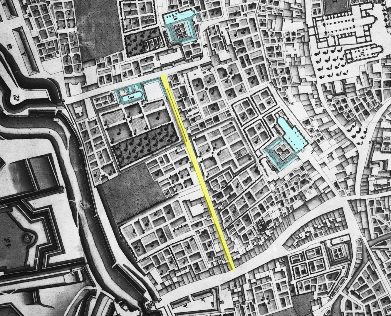
English: Detail of a map of Maastricht, Netherlands, showing the western part of the city in 1749. The map by French military engineer Jean-Baptiste Larcher d'Aubencourt was used to build the Maquette of Maastricht (1752), now in the Musée de Beaux Arts in Lille, France. Here the area around Abtstraat (marked in yellow). Top right: Vrijthof square. Marked in blue: Calvary Monastery, Crozier Monastery and Second Minorite Monastery. |
| Datum | |
| Bron | http://beeldbank.cultureelerfgoed.nl/alle-afbeeldingen/weergave/search/layout/result/indeling/detail/start/2?searchfield=Larcher+d%5C%5C%5C%27Aubancourt |
| Auteur | Jean-Baptiste Larcher d'Aubencourt, 1749 |
Licentie
|
Dit werk bevindt zich in het publiek domein in landen en gebieden waar de auteursrechttermijn het leven van de auteur plus 100 jaar of minder is. | |
| Van dit bestand is vastgesteld dat er geen bekende auteursrechtaanspraken op rusten, alle aanverwante en naburige rechten daarbij inbegrepen. | |
Bestandsgeschiedenis
Klik op een datum/tijd om het bestand te zien zoals het destijds was.
| Datum/tijd | Miniatuur | Afmetingen | Gebruiker | Opmerking | |
|---|---|---|---|---|---|
| huidige versie | 6 dec 2018 01:35 | | 1.331 × 1.075 (737 kB) | Kleon3 | blue marked areas expanded |
| 6 dec 2018 01:19 |  | 1.331 × 1.075 (732 kB) | Kleon3 | User created page with UploadWizard |
Bestandsgebruik
Dit bestand wordt op de volgende pagina gebruikt: