
Bestand:Bahnkarte Deutschland 1861.jpg
Grootte van deze voorvertoning: 771 × 599 pixels. Andere resoluties: 309 × 240 pixels | 618 × 480 pixels | 988 × 768 pixels | 1.280 × 995 pixels | 2.560 × 1.990 pixels | 4.878 × 3.792 pixels.
Oorspronkelijk bestand (4.878 × 3.792 pixels, bestandsgrootte: 19,41 MB, MIME-type: image/jpeg)
| Dit is een bestand van Wikimedia Commons. Onderstaande beschrijving komt van de beschrijving van het bestand daar. |
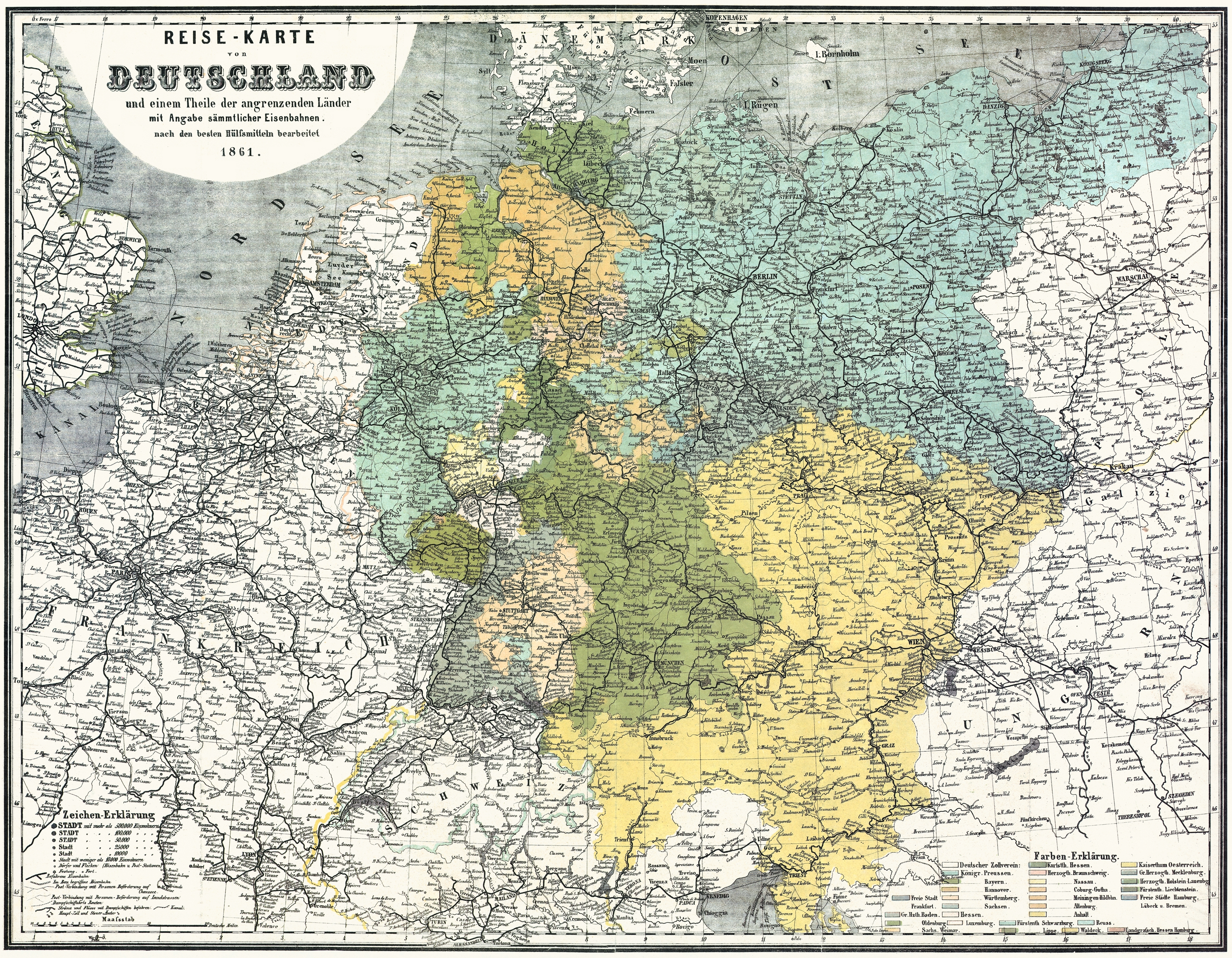
| Beschrijving | Bahnkarte_Deutschland_1861 |
| Datum | |
| Bron | Karten- und Luftbildstelle der DB Mainz |
| Auteur | Onbekend |
| Andere versies | Afgeleide werken van dit bestand: Bahnstrecken München 1861.jpg |
|
Dit werk bevindt zich in het publiek domein in landen en gebieden waar de auteursrechttermijn het leven van de auteur plus 100 jaar of minder is. | |
| Van dit bestand is vastgesteld dat er geen bekende auteursrechtaanspraken op rusten, alle aanverwante en naburige rechten daarbij inbegrepen. | |
Bestandsgeschiedenis
Klik op een datum/tijd om het bestand te zien zoals het destijds was.
| Datum/tijd | Miniatuur | Afmetingen | Gebruiker | Opmerking | |
|---|---|---|---|---|---|
| huidige versie | 17 nov 2008 16:43 | | 4.878 × 3.792 (19,41 MB) | Jom | {{Information |Description=Bahnkarte_Deutschland_1861 |Source=Karten- und Luftbildstelle der DB Mainz |Date=1861 |Author=unknown |Permission= |other_versions= }} {{PD-old-100}} Category:Maps of the history of Germany [[Category:Public transport maps o |
Bestandsgebruik
Dit bestand wordt op de volgende pagina gebruikt:
Globaal bestandsgebruik
De volgende andere wiki's gebruiken dit bestand:
- Gebruikt op cs.wikipedia.org
- Gebruikt op de.wikipedia.org
- Gebruikt op en.wikipedia.org
- Gebruikt op pl.wikipedia.org
- Gebruikt op zh.wikipedia.org