
Bestand:Coropgebieden plain.png
Grootte van deze voorvertoning: 515 × 599 pixels. Andere resoluties: 206 × 240 pixels | 412 × 480 pixels | 660 × 768 pixels | 1.027 × 1.195 pixels.
Oorspronkelijk bestand (1.027 × 1.195 pixels, bestandsgrootte: 146 kB, MIME-type: image/png)
| Dit is een bestand van Wikimedia Commons. Onderstaande beschrijving komt van de beschrijving van het bestand daar. |
Beschrijving
| Beschrijving |
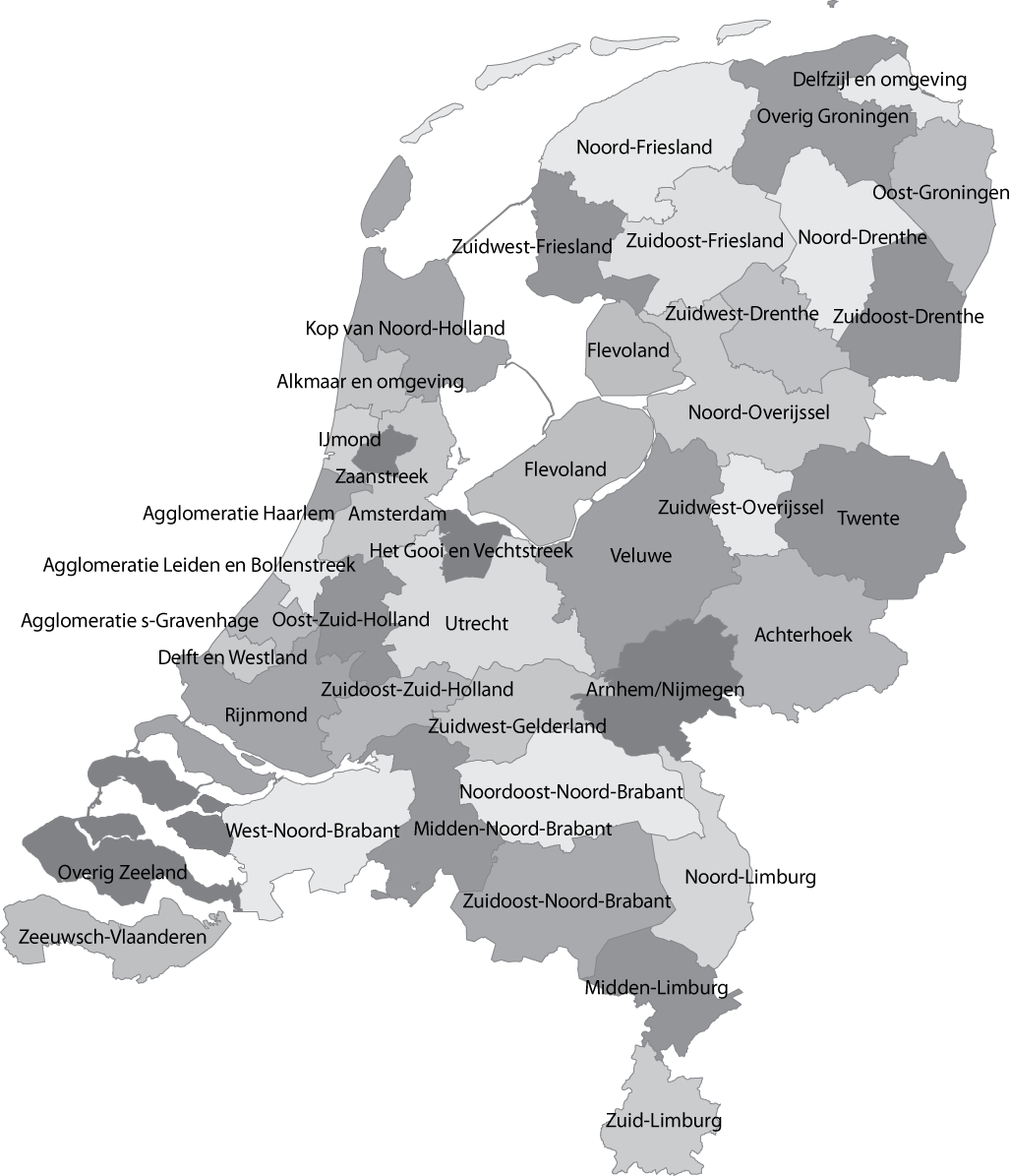
English: Map of the Dutch NUTS3 regions (COROP regions). Made using GIS software. |
| Datum | |
| Bron | Eigen werk |
| Auteur | Classical geographer |
| Andere versies | Afgeleide werken van dit bestand: Islam in Netherlands.jpg |
Licentie
| Dit bestand is beschikbaar onder Creative Commons CC0 1.0 Universele Public Domain Dedication. | |
| De persoon die een werk voorziet van deze licentie stelt dit werk beschikbaar aan het publieke domein door, voor zover dit wettelijk is toegestaan, afstand te doen van alle rechten op het werk in de zin van het auteursrecht, met inbegrip van alle aanverwante of naburige rechten. U kunt het werk kopiëren, aanpassen, distribueren en uitvoeren, ook voor commerciële doeleinden, zonder dat u daarvoor toestemming hoeft te vragen.
|
Bestandsgeschiedenis
Klik op een datum/tijd om het bestand te zien zoals het destijds was.
| Datum/tijd | Miniatuur | Afmetingen | Gebruiker | Opmerking | |
|---|---|---|---|---|---|
| huidige versie | 8 jan 2011 14:04 | | 1.027 × 1.195 (146 kB) | Classical geographer | Updated Tholen/St. Philipsland (belong to Overig Zeeland, not to Rijnmond). |
| 28 jul 2010 18:31 |  | 1.027 × 1.195 (209 kB) | Classical geographer | Without border. | |
| 28 jul 2010 18:30 |  | 1.102 × 1.300 (211 kB) | Classical geographer | B&W and with more readable labels. | |
| 9 jul 2009 13:31 |  | 1.199 × 1.407 (541 kB) | Classical geographer | Category:Maps of the Netherlands Category:Statistical divisions | |
| 9 jul 2009 13:30 |  | 3.588 × 3.529 (553 kB) | Classical geographer | {{Information |Description={{en|1=Map of the Dutch NUTS3 regions (COROP regions). Made using GIS software.}} |Source=Own work by uploader |Author=Classical geographer |Date=2009-07-09 |Permission= |other_versions= }} [[Categ |
Bestandsgebruik
Dit bestand wordt op de volgende 3 pagina's gebruikt:
Globaal bestandsgebruik
De volgende andere wiki's gebruiken dit bestand:
- Gebruikt op ar.wikipedia.org
- Gebruikt op ca.wikipedia.org
- Gebruikt op en.wikipedia.org
- Gebruikt op es.wikipedia.org
- Gebruikt op fr.wikipedia.org