
Bestand:European Union Ukraine Locator.svg

Afmetingen van deze voorvertoning van het type PNG van dit SVG-bestand: 587 × 600 pixels Andere resoluties: 235 × 240 pixels | 470 × 480 pixels | 752 × 768 pixels | 1.002 × 1.024 pixels | 2.004 × 2.048 pixels | 593 × 606 pixels.
Oorspronkelijk bestand (SVG-bestand, nominaal 593 × 606 pixels, bestandsgrootte: 711 kB)
| Dit is een bestand van Wikimedia Commons. Onderstaande beschrijving komt van de beschrijving van het bestand daar. |
Beschrijving
| Beschrijving |
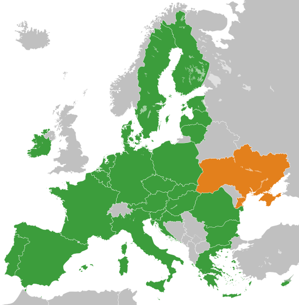
English: The European Union and Ukraine. Українська: Європейський Союз і Україна. Español: La Unión Europea y Ucrania. Deutsch: Die Europäische Union und die Ukraine. العربية: الاتحاد الأوروبي وأوكرانيا. فارسی: اتحادیه اروپا و اوکراین. |
| Datum | |
| Bron |
Eigen werk Deze niet W3C-verklaarde vectorafbeelding is gemaakt met Inkscape . |
| Auteur | S. Solberg J. |
Licentie
| Ik, de auteursrechthebbende van dit werk, geef dit werk vrij in het publieke domein. Dit is wereldwijd van toepassing. In sommige landen is dit wettelijk niet mogelijk; in die gevallen geldt: Ik sta iedereen toe dit werk voor eender welk doel te gebruiken, zonder enige voorwaarden, tenzij zulke voorwaarden door de wet worden voorgeschreven. |
| This map is ineligible for copyright and therefore in the public domain, because it consists entirely of information that is common property and contains no original authorship. For more information, see Commons:Threshold of originality § Maps.
|
Bestandsgeschiedenis
Klik op een datum/tijd om het bestand te zien zoals het destijds was.
| Datum/tijd | Miniatuur | Afmetingen | Gebruiker | Opmerking | |
|---|---|---|---|---|---|
| huidige versie | 20 nov 2022 15:40 | | 593 × 606 (711 kB) | M.Bitton | Reverted to version as of 01:53, 19 November 2022 (UTC): per COM:OVERWRITE. 2016 was 6 years ago, making this map stable. Feel free to upload under a different name |
| 20 nov 2022 10:48 |  | 593 × 606 (712 kB) | Рагин1987 | Removed the gray square at the maritime borders of Spain. Slightly expanded the map to the borders of Georgia (the territory of Abkhazia), since Georgia, like Moldova, is a member of the Eastern Partnership, an associated trio and applied for EU membership. Please, before automatically referring to COM:OVERWRITE, take a close look at the history of the file, and the fact that its format was radically edited in 2016. | |
| 19 nov 2022 03:53 |  | 593 × 606 (711 kB) | M.Bitton | Reverted to version as of 14:42, 3 July 2020 (UTC): meaningless edit summary | |
| 18 nov 2022 15:06 |  | 593 × 606 (710 kB) | Рагин1987 | Small correction | |
| 3 jul 2020 16:42 |  | 593 × 606 (711 kB) | Halbgeviertstrich | Reverted presumably accidental colour change for Malta | |
| 5 feb 2020 14:42 |  | 593 × 606 (711 kB) | Darranc | Reverted to version as of 11:57, 3 February 2020 (UTC) - UK isn't in the EU. This file name is a Ukraine locator in relation to the EU | |
| 3 feb 2020 19:22 |  | 593 × 606 (711 kB) | L.tak | update UK (former member, colour #123456, still applies the treaty in transition phase) | |
| 3 feb 2020 19:14 |  | 680 × 520 (604 kB) | L.tak | Reverted to version as of 18:15, 26 October 2016 (UTC): Still applicable in the UK during transition phase | |
| 3 feb 2020 13:57 |  | 593 × 606 (711 kB) | Darranc | Remove UK from EU | |
| 26 okt 2016 20:15 |  | 680 × 520 (604 kB) | Giorgi Balakhadze | Rv of sockpuppet and per COM:OVERWRITE |
Bestandsgebruik
Dit bestand wordt op de volgende 2 pagina's gebruikt:
Globaal bestandsgebruik
De volgende andere wiki's gebruiken dit bestand:
- Gebruikt op ar.wikipedia.org
- Gebruikt op ca.wikipedia.org
- Gebruikt op de.wikipedia.org
- Ukraine und die Europäische Union
- Benutzer:Francis McLloyd/Interessengebiet Ukraine
- Assoziierungsabkommen zwischen der Europäischen Union und der Ukraine
- Delegation der Europäischen Union für die Ukraine
- Wikipedia:Kartenwerkstatt/Archiv/Zurückgewiesene und zurückgestellte Aufträge 2015
- Beitrittsverhandlungen der Ukraine mit der Europäischen Union
- Gebruikt op en.wikipedia.org
- User:Lionheart Omega
- User:Yulia Romero
- User:Idaltu
- Ukraine–European Union relations
- User:Dirtybutclean
- User:Manuela Listkiewska
- User:Narking
- User:Deavenger
- User:Yulia Romero/OpinionsOfYulia Romero
- User:Yulia Romero/Userbox/EU enlargement Ukraine
- User:Bolegash
- User:Gggh
- User:PKLion
- User:Temujin321
- User:Balkanian`s word
- User talk:A Nobody/Deletion discussions
- User:A.h. king/Userbox/No EU enlargement Ukraine
- User:EllsworthSK
- User:Smart30
- User:Bouncingnewsgreen
- User:Nickispeaki
- User:MAXXX-309
- User:Biletsky Volodymyr
- Accession of Ukraine to the European Union
- User:Julianhayda
- User:AlonsoRiveraM
- User:K9re11
- User:Liegger
- User:Patersonp6
- User:Michalgill
- User:Oleh Kushch
- User:+JMJ+
- Wikipedia:Userboxes/Politics/Multinational/European Union
- Wikipedia:Userboxes/Politics by country/Ukraine
- User:JaikeV
- User:Nomadbones
- User:TheTurtleHistorian
Globaal gebruik van dit bestand bekijken.