
Bestand:Jersey.png
Grootte van deze voorvertoning: 800 × 554 pixels. Andere resoluties: 320 × 222 pixels | 640 × 443 pixels | 1.024 × 709 pixels | 1.253 × 868 pixels.
Oorspronkelijk bestand (1.253 × 868 pixels, bestandsgrootte: 42 kB, MIME-type: image/png)
| Dit is een bestand van Wikimedia Commons. Onderstaande beschrijving komt van de beschrijving van het bestand daar. |

|
This map has been uploaded by Electionworld from en.wikipedia.org to enable the |
Beschrijving
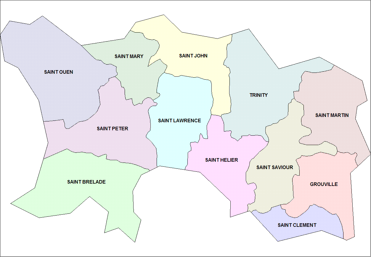
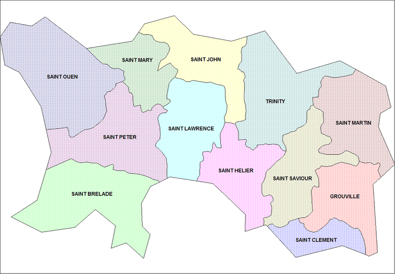
Map of the parishes of Jersey. Created by Rarelibra for public domain use. Created using MapInfo Professional v7.5 and various mapping resources.
Licentie
| Ik, de auteursrechthebbende van dit werk, geef dit werk vrij in het publieke domein. Dit is wereldwijd van toepassing. In sommige landen is dit wettelijk niet mogelijk; in die gevallen geldt: Ik sta iedereen toe dit werk voor eender welk doel te gebruiken, zonder enige voorwaarden, tenzij zulke voorwaarden door de wet worden voorgeschreven. |
Bestandsgeschiedenis
Klik op een datum/tijd om het bestand te zien zoals het destijds was.
| Datum/tijd | Miniatuur | Afmetingen | Gebruiker | Opmerking | |
|---|---|---|---|---|---|
| huidige versie | 27 nov 2006 00:21 | | 1.253 × 868 (42 kB) | Electionworld | {{ew|en|Rarelibra}} == Summary == Map of the parishes of Jersey. Created by Rarelibra for public domain use. Created using MapInfo Professional v7.5 and various mapping resources. == Licensing == {{PD-self}} [[Category:Maps of J |
Bestandsgebruik
Dit bestand wordt op de volgende pagina gebruikt:
Globaal bestandsgebruik
De volgende andere wiki's gebruiken dit bestand:
- Gebruikt op br.wikipedia.org
- Gebruikt op de.wikipedia.org
- Gebruikt op el.wikipedia.org
- Gebruikt op en.wikipedia.org
- Gebruikt op fr.wikipedia.org
- Gebruikt op pl.wikipedia.org
- Gebruikt op ro.wikipedia.org