
Bestand:Map Gaels Brythons Picts GB.png
Geen hogere resolutie beschikbaar.
Map_Gaels_Brythons_Picts_GB.png (220 × 284 pixels, bestandsgrootte: 26 kB, MIME-type: image/png)
| Dit is een bestand van Wikimedia Commons. Onderstaande beschrijving komt van de beschrijving van het bestand daar. |
Beschrijving
| Beschrijving |
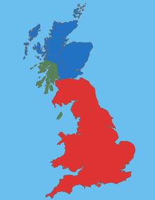
English: Map Gaels Brythons Picts GB |
| Bron | Eigen werk |
| Auteur | malus36 |
Licentie
| Dit werk komt niet in aanmerking voor auteursrechtelijke bescherming, omdat het volledig uit algemeen beschikbare informatie bestaat en geen origineel auteurschap bevat; derhalve valt het werk in het publieke domein. |
Bestandsgeschiedenis
Klik op een datum/tijd om het bestand te zien zoals het destijds was.
| Datum/tijd | Miniatuur | Afmetingen | Gebruiker | Opmerking | |
|---|---|---|---|---|---|
| huidige versie | 16 jan 2010 16:17 | | 220 × 284 (26 kB) | Malus36 | {{Information |Description={{en|1=Map Gaels Brythons Picts GB}} |Source=own work |Author=malus36 |Date= |Permission= |other_versions= }} |
Bestandsgebruik
Dit bestand wordt op de volgende pagina gebruikt:
Globaal bestandsgebruik
De volgende andere wiki's gebruiken dit bestand:
- Gebruikt op ca.wikipedia.org
- Gebruikt op de.wikipedia.org
- Gebruikt op el.wikipedia.org
- Gebruikt op en.wikipedia.org
- Gebruikt op es.wikipedia.org
- Gebruikt op fa.wikipedia.org
- Gebruikt op fi.wikipedia.org
- Gebruikt op fr.wikipedia.org
- Gebruikt op fy.wikipedia.org
- Gebruikt op hr.wikipedia.org
- Gebruikt op id.wikipedia.org
- Gebruikt op is.wikipedia.org
- Gebruikt op ka.wikipedia.org
- Gebruikt op ko.wikipedia.org
- Gebruikt op pt.wikipedia.org
- Gebruikt op ro.wikipedia.org
- Gebruikt op sh.wikipedia.org
- Gebruikt op si.wikipedia.org
- Gebruikt op sl.wikipedia.org
- Gebruikt op ta.wikipedia.org
- Gebruikt op tr.wikipedia.org
- Gebruikt op uk.wikipedia.org
- Gebruikt op vi.wikipedia.org
- Gebruikt op www.wikidata.org
- Gebruikt op zh.wikipedia.org