
Bestand:Mount Malinao.jpg
Geen hogere resolutie beschikbaar.
Mount_Malinao.jpg (640 × 416 pixels, bestandsgrootte: 43 kB, MIME-type: image/jpeg)
| Dit is een bestand van Wikimedia Commons. Onderstaande beschrijving komt van de beschrijving van het bestand daar. |
Beschrijving
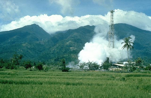
| Beschrijving | Mount Malinao is a forested stratovolcano with a summit crater that is breached to the east. The Tiwi geothermal field, seen here with the volcano in the background, is located on the east flanks of Malinao. The geothermal field is located near Luzon's largest fumarole field, which includes siliceous sinter deposits at Naglabong. |
| Datum | Datum onbekend |
| Bron | http://www.volcano.si.edu/world/volcano.cfm?vnum=070304=A&volpage=photos&photo=018037 |
| Auteur | Chris Newhall (U.S. Geological Survey) |
Licentie
Deze afbeelding bevindt zich in het publiek domein omdat het materiaal bevat dat oorspronkelijk afkomstig is van de United States Geological Survey, een agentschap van de United States Department of the Interior. Voor meer informatie, zie het officiële USGS-auteursrechtenbeleid
|
Bestandsgeschiedenis
Klik op een datum/tijd om het bestand te zien zoals het destijds was.
| Datum/tijd | Miniatuur | Afmetingen | Gebruiker | Opmerking | |
|---|---|---|---|---|---|
| huidige versie | 11 okt 2010 20:00 | | 640 × 416 (43 kB) | Michael Metzger | {{Information |Description=Mount Malinao is a forested stratovolcano with a summit crater that is breached to the east. The Tiwi geothermal field, seen here with the volcano in the background, is located on the east flanks of Malinao. The geothermal field |
Bestandsgebruik
Dit bestand wordt op de volgende pagina gebruikt:
Globaal bestandsgebruik
De volgende andere wiki's gebruiken dit bestand:
- Gebruikt op arz.wikipedia.org
- Gebruikt op bcl.wikipedia.org
- Gebruikt op cs.wikipedia.org
- Gebruikt op de.wikipedia.org
- Gebruikt op en.wikipedia.org
- Gebruikt op fa.wikipedia.org
- Gebruikt op fr.wikipedia.org
- Gebruikt op ilo.wikipedia.org
- Gebruikt op lld.wikipedia.org
- Gebruikt op www.wikidata.org