
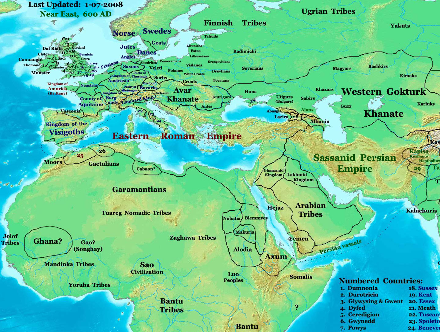
Bestand:NE 600ad.jpg
Oorspronkelijk bestand (1.439 × 1.086 pixels, bestandsgrootte: 1,14 MB, MIME-type: image/jpeg)
| Dit is een bestand van Wikimedia Commons. Onderstaande beschrijving komt van de beschrijving van het bestand daar. |
Beschrijving
| Beschrijving |
English: part of: Eastern Hemisphere in 600 AD.
Description: This image is a zoomed-in version of the Eastern Hemisphere in 600 AD. Author: Thomas A. Lessman (talessman@yis.us), later modified by others. Source URL: http://www.worldhistorymaps.info/images/East-Hem_600ad.jpg. Image Summary:Created by Thomas Lessman, based on this map of Eastern Hemisphere in 600 AD. Free for educational use. If you use this image, please credit the author (Thomas Lessman) and include (Source URL: http://www.worldhistorymaps.info/images/East-Hem_600ad.jpg). If you can help improve this map, please contact Thomas Lessman at talessman@yis.us. Other Historical Maps by Thomas Lessman
|
|||||||||||||||||||||||||
| Datum | 17 januari 2008 (originele uploaddatum) | |||||||||||||||||||||||||
| Bron | Verplaatst vanaf en.wikipedia naar Commons. | |||||||||||||||||||||||||
| Auteur | Talessman op de Engelstalige Wikipedia | |||||||||||||||||||||||||
| Toestemming (Hergebruik van dit bestand) |
|
|||||||||||||||||||||||||
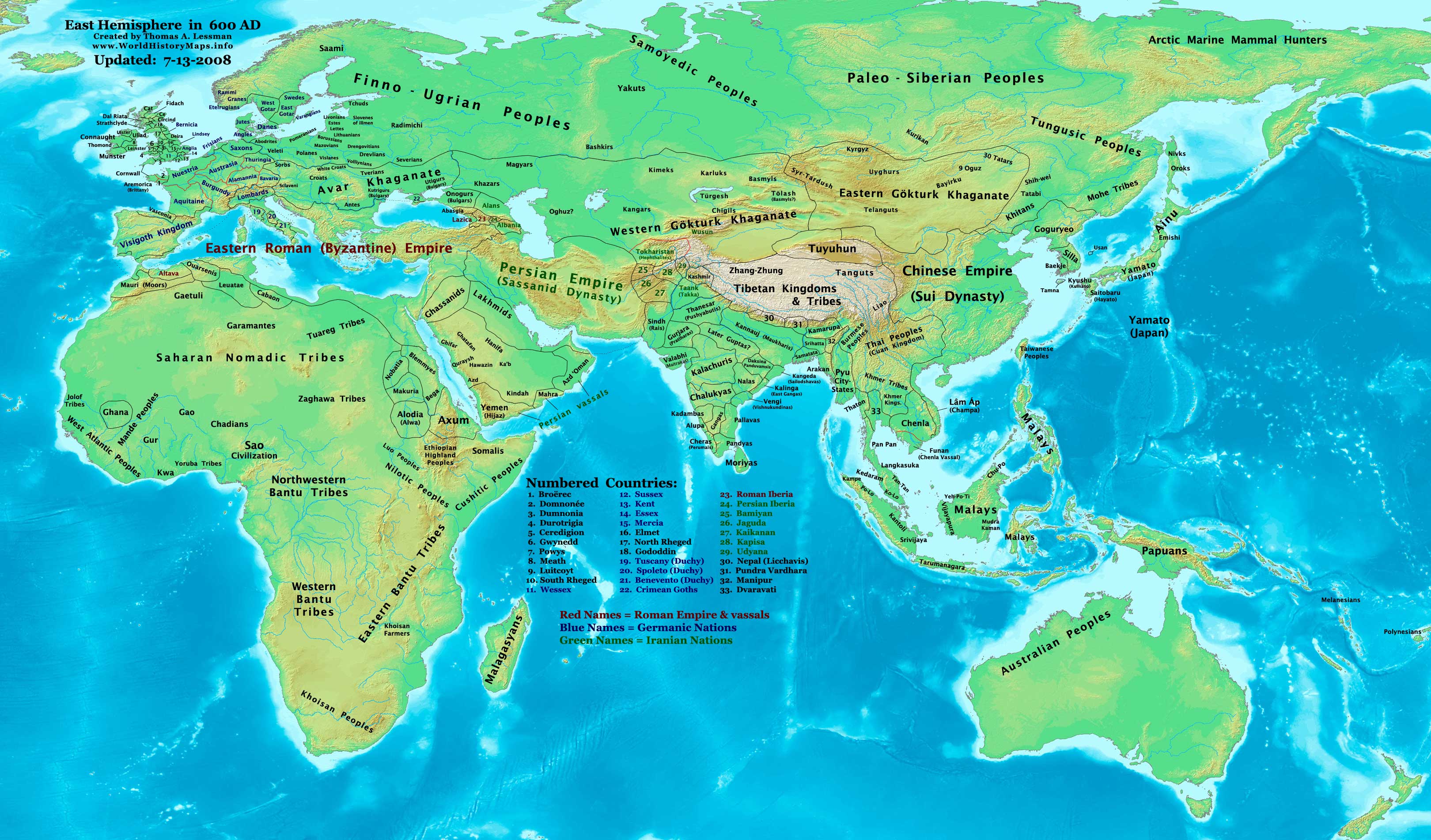
| Andere versies | Disputed map because the version with « Romanised Dacians » (= Olahok, Vlachs) and « Slavs » (Totok, Slavons, Slovens...) may be a romanian and slavic POV, but this « Only Avars and no other people north of the Danube, in the future Kingdom of Hungary », according to the Eduard Rössler's « Awarenwüste » theory, shows an Austrian-Hungarian POV: one is not more objective than the other and unfortunately no synthesis is possible. | |||||||||||||||||||||||||
Licentie

|
Toestemming wordt verleend voor het kopiëren, verspreiden en/of wijzigen van dit document onder de voorwaarden van de GNU-licentie voor vrije documentatie, versie 1.2 of enige latere versie als gepubliceerd door de Free Software Foundation; zonder Invariant Sections, zonder Front-Cover Texts, en zonder Back-Cover Texts. Een kopie van de licentie is opgenomen in de sectie GNU-licentie voor vrije documentatie. |
| Dit bestand is gelicenseerd onder de Creative Commons-licentie Naamsvermelding-Gelijk delen 3.0 Unported | ||
| Naamsvermelding: Talessman at the English Wikipedia | ||
| ||
| Deze licentietag is toegevoegd aan dit bestand in verband met de GFDL licentie-update. |
| Maps of the eastern hemisphere showing history
Bold dates are available on Wikimedia or Wikipedia. | ||
| Primeval | ||
| Ancient
|
·| 600 BC | 550 BC | 527 BC | 500 BC |
400 BC | ·| 1 AD | 50 AD | 100 AD | 200 AD | 300 AD | | |
| Medieval |
·| 500 AD | 565 AD | 600 AD | 700 AD | | |
| Modern |
·| 1500 AD | · * For historical maps of the whole world, | |
·
Oorspronkelijk uploadlogboek
- 2008-01-17 20:07 Talessman 1439×1086× (513542 bytes) Added more info for Africa, corrected some info on Europe.
- 2007-11-02 18:55 Talessman 1450×988× (440135 bytes) Corrected borders in Africa/Sudan and Arabia.
- 2007-10-31 20:30 Talessman 1429×927× (437106 bytes) Corrected borders of Ghana, made other names easier to read, other misc. corrections.
- 2007-10-21 00:19 Talessman 1251×779× (341469 bytes) Author: Thomas A. Lessman. Source URL: http://www.ThomasLessman.com/History/images/East-Hem_600ad.jpg. Image was created by me (Thomas Lessman) based on map of Eastern Hemisphere in 600ad. Image is free for public and/or educational use. I would appreciat
Bestandsgeschiedenis
Klik op een datum/tijd om het bestand te zien zoals het destijds was.
| Datum/tijd | Miniatuur | Afmetingen | Gebruiker | Opmerking | |
|---|---|---|---|---|---|
| huidige versie | 7 mrt 2024 19:26 | | 1.439 × 1.086 (1,14 MB) | Nihil scimus | Restored a more accurate map uploaded march 15, 2023 by Moodylo333: Armenia was not Byzantine (see Claude Murafian's & Eric Van Lauwe's ''Atlas historique de l'Arménie'', Autrement publ., ISBN 2746701006); Highlighted the boundaries of the Eastern Roman Empire, Sassanid Persia and the Göktürk Khanate; Drawn the Slavic perimeter and reduced the Avar perimeter (greatly exaggerated) according to [https://commons.wikimedia.org/wiki/File:Avar_settlement_area.jpg] and to Vladislav Popovic's «La des... |
| 26 sep 2023 21:28 |  | 1.439 × 1.086 (502 kB) | OrionNimrod | Reverted to version as of 09:20, 1 February 2009 (UTC) keep original | |
| 15 mrt 2023 18:28 |  | 1.439 × 1.086 (1,14 MB) | Moodylo333 | More accurate map: see explanations. | |
| 28 okt 2022 15:38 |  | 1.439 × 1.086 (502 kB) | OrionNimrod | Reverted to version as of 09:20, 1 February 2009 (UTC) "Romance Dacians in 600" in Transylvania is clearly a Romanian nationalist POV, and there is Avar archeological sites, but the Avar territory was decreased in the updated map. Dacians in 600??? | |
| 27 okt 2022 17:47 |  | 1.439 × 1.086 (744 kB) | Nihil scimus | Modifications from academic historical books do not "invent nations" or falsifie Commons' digital incomplete maps, but enrich them. | |
| 6 okt 2022 19:29 |  | 1.439 × 1.086 (502 kB) | OrionNimrod | Reverted to version as of 09:20, 1 February 2009 (UTC) restored the original one which was extract from the big original map, the map was falsified with did not exist nations at that time 600 AD | |
| 11 dec 2014 14:55 |  | 1.439 × 1.086 (744 kB) | Spiridon Ion Cepleanu | Garamantian & Arabic tribes areas | |
| 20 nov 2014 19:26 |  | 1.439 × 1.086 (742 kB) | Spiridon Ion Cepleanu | Lakes & Caspian shorelines | |
| 15 nov 2014 15:21 |  | 1.439 × 1.086 (737 kB) | Spiridon Ion Cepleanu | Add missing names: Altava, Warsenia, Iberia, Kaikanan | |
| 15 nov 2014 15:00 |  | 1.439 × 1.086 (736 kB) | Spiridon Ion Cepleanu | Little cosmetic adds (seas names in this time, etc) |
Bestandsgebruik
Dit bestand wordt op de volgende pagina gebruikt:
Globaal bestandsgebruik
De volgende andere wiki's gebruiken dit bestand:
- Gebruikt op ast.wikipedia.org
- Gebruikt op az.wikipedia.org
- Gebruikt op ba.wikipedia.org
- Gebruikt op bg.wikipedia.org
- Gebruikt op ca.wikipedia.org
- Gebruikt op cv.wikipedia.org
- Gebruikt op el.wikipedia.org
- Gebruikt op en.wikipedia.org
- Gebruikt op en.wikiversity.org
- Gebruikt op es.wikipedia.org
- Gebruikt op fa.wikipedia.org
- Gebruikt op fr.wikipedia.org
- Gebruikt op hu.wikipedia.org
- Gebruikt op id.wikipedia.org
- Gebruikt op it.wikipedia.org
- Gebruikt op ja.wikipedia.org
- Gebruikt op ko.wikipedia.org
Globaal gebruik van dit bestand bekijken.