
Bestand:NOAA Pearl Harbor Approach Map.jpg
Grootte van deze voorvertoning: 445 × 599 pixels. Andere resoluties: 178 × 240 pixels | 356 × 480 pixels | 570 × 768 pixels | 761 × 1.024 pixels | 1.521 × 2.048 pixels | 5.291 × 7.123 pixels.
Oorspronkelijk bestand (5.291 × 7.123 pixels, bestandsgrootte: 3,78 MB, MIME-type: image/jpeg)
| Dit is een bestand van Wikimedia Commons. Onderstaande beschrijving komt van de beschrijving van het bestand daar. |
Beschrijving
| Beschrijving |
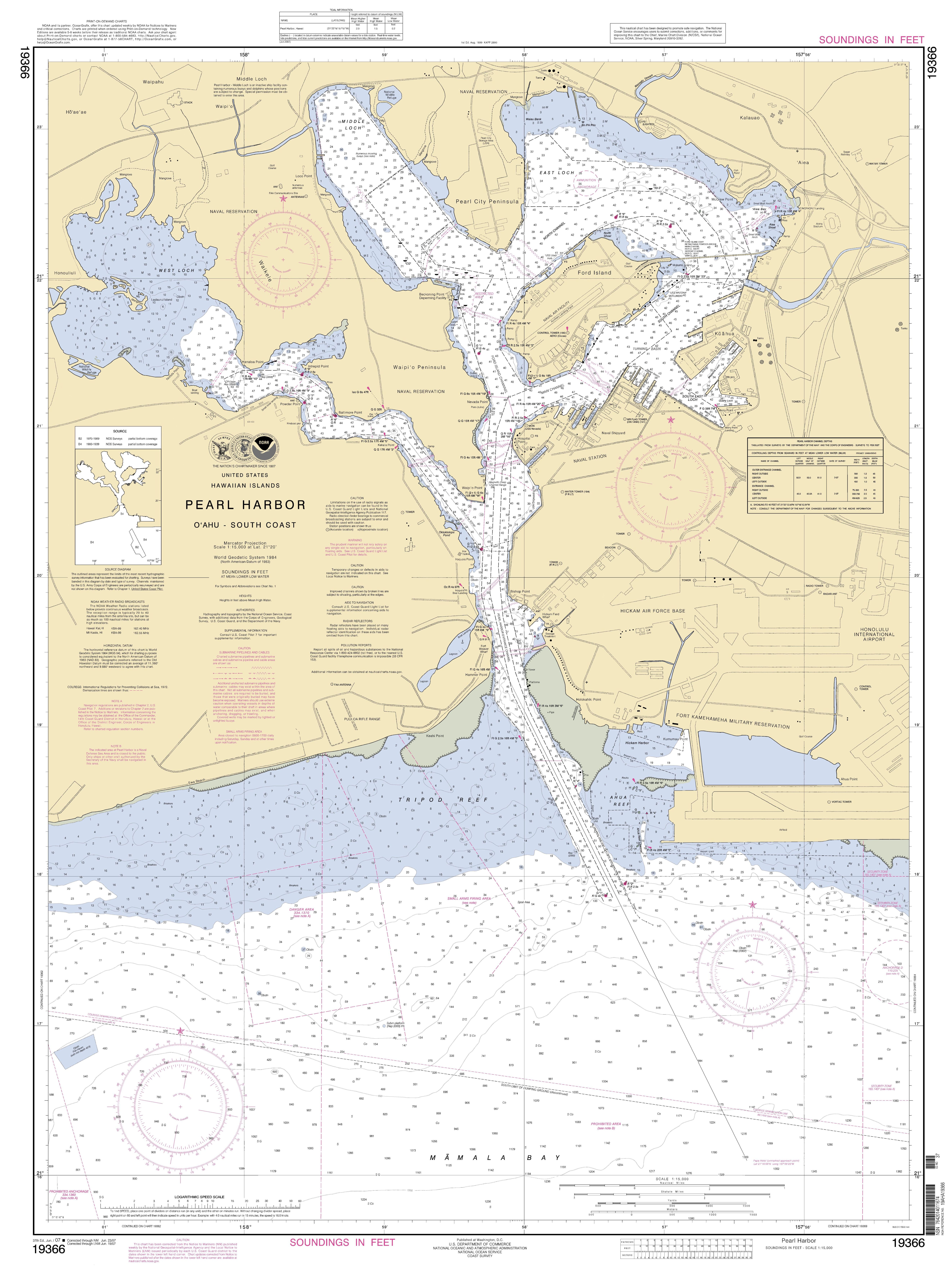
English: National Oceanic and Atmospheric Administration approach map for Pearl Harbor |
| Datum | |
| Bron | http://www.charts.noaa.gov/OnLineViewer/19366.shtml |
| Auteur | Employee of the NOAA |
Licentie
Deze afbeelding is in het publiek domein omdat het materiaal bevat dat oorspronkelijk van de National Oceanic and Atmospheric Administration kwam in de Verenigde Staten en genomen of gemaakt is tijdens de officiële werkzaamheden van een werknemer.
|
Bestandsgeschiedenis
Klik op een datum/tijd om het bestand te zien zoals het destijds was.
| Datum/tijd | Miniatuur | Afmetingen | Gebruiker | Opmerking | |
|---|---|---|---|---|---|
| huidige versie | 25 mei 2014 20:42 | | 5.291 × 7.123 (3,78 MB) | TParis | Entire map |
| 25 mei 2014 20:31 |  | 256 × 256 (17 kB) | TParis | {{Information |Description ={{en|1=National Oceanic and Atmospheric Administration approach map for Pearl Harbor}} |Source =http://www.charts.noaa.gov/OnLineViewer/19366.shtml |Author =Employee of the NOAA |Date =2014-04-21... |
Bestandsgebruik
Dit bestand wordt op de volgende pagina gebruikt:
Globaal bestandsgebruik
De volgende andere wiki's gebruiken dit bestand:
- Gebruikt op ar.wikipedia.org
- Gebruikt op de.wikipedia.org
- Gebruikt op en.wikipedia.org
- Gebruikt op fa.wikipedia.org
- Gebruikt op id.wikipedia.org
- Gebruikt op ja.wikipedia.org
- Gebruikt op vi.wikipedia.org