
Bestand:Sri Lanka relief location map.jpg

Grootte van deze voorvertoning: 391 × 599 pixels. Andere resoluties: 157 × 240 pixels | 313 × 480 pixels | 501 × 768 pixels | 1.200 × 1.838 pixels.
Oorspronkelijk bestand (1.200 × 1.838 pixels, bestandsgrootte: 935 kB, MIME-type: image/jpeg)
| Dit is een bestand van Wikimedia Commons. Onderstaande beschrijving komt van de beschrijving van het bestand daar. |
Beschrijving
| Beschrijving |
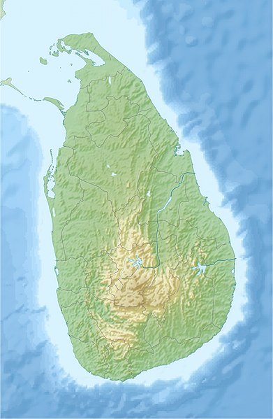
English: Location map of Sri Lanka.
Equirectangular projection. Strechted by 101.0%. Geographic limits of the map: * N: 10.2° N * S: 5.5° N * W: 79.2° E * E: 82.3° EMade with Natural Earth. Free vector and raster map data @ naturalearthdata.com. |
| Datum | |
| Bron | Eigen werk |
| Auteur | Uwe Dedering |
| Andere versies |
|

Licentie
Ik, de auteursrechthebbende van dit werk, maak het hierbij onder de volgende licenties beschikbaar:
Dit bestand is gelicenseerd onder de Creative Commons-licentie Naamsvermelding-Gelijk delen 3.0 Unported
- De gebruiker mag:
- Delen – het werk kopiëren, verspreiden en doorgeven
- Remixen – afgeleide werken maken
- Onder de volgende voorwaarden:
- naamsvermelding – U moet op een gepaste manier aan naamsvermelding doen, een link naar de licentie geven, en aangeven of er wijzigingen in het werk zijn aangebracht. U mag dit op elke redelijke manier doen, maar niet zodanig dat de indruk wordt gewekt dat de licentiegever instemt met uw werk of uw gebruik van zijn werk.
- Gelijk delen – Als u het werk heeft geremixt, veranderd, of erop heeft voortgebouwd, moet u het gewijzigde materiaal verspreiden onder dezelfde licentie als het oorspronkelijke werk, of een daarmee compatibele licentie.

|
Toestemming wordt verleend voor het kopiëren, verspreiden en/of wijzigen van dit document onder de voorwaarden van de GNU-licentie voor vrije documentatie, versie 1.2 of enige latere versie als gepubliceerd door de Free Software Foundation; zonder Invariant Sections, zonder Front-Cover Texts, en zonder Back-Cover Texts. Een kopie van de licentie is opgenomen in de sectie GNU-licentie voor vrije documentatie. |
U mag zelf één van de licenties kiezen.
Bestandsgeschiedenis
Klik op een datum/tijd om het bestand te zien zoals het destijds was.
| Datum/tijd | Miniatuur | Afmetingen | Gebruiker | Opmerking | |
|---|---|---|---|---|---|
| huidige versie | 3 jul 2020 18:44 | | 1.200 × 1.838 (935 kB) | C1MM | Reverted to version as of 10:24, 24 April 2010 (UTC) |
| 21 apr 2020 07:43 |  | 1.200 × 1.838 (155 kB) | C1MM | More accurate STRM data | |
| 24 apr 2010 12:24 |  | 1.200 × 1.838 (935 kB) | Uwe Dedering | fixed opacity | |
| 24 apr 2010 12:07 |  | 1.200 × 1.838 (913 kB) | Uwe Dedering | {{Information |Description={{en|1=Location map of Sri Lanka. Equirectangular projection. Strechted by 101.0%. Geographic limits of the map: * N: 10.2° N * S: 5.5° N * W: 79.2° E * E: 82.3° E Made with Natural Earth. Free vector and raster map da |
Bestandsgebruik
Dit bestand wordt op de volgende 6 pagina's gebruikt:
Globaal bestandsgebruik
De volgende andere wiki's gebruiken dit bestand:
- Gebruikt op ar.wikipedia.org
- Gebruikt op av.wikipedia.org
- Gebruikt op az.wikipedia.org
- Gebruikt op be.wikipedia.org
- Gebruikt op bg.wikipedia.org
- Gebruikt op bn.wikipedia.org
- Gebruikt op bs.wikipedia.org
- Gebruikt op ceb.wikipedia.org
- Gebruikt op ce.wikipedia.org
- Gebruikt op ckb.wikipedia.org
- Gebruikt op cs.wikipedia.org
- Gebruikt op de.wikipedia.org
- Gebruikt op de.wikivoyage.org
Globaal gebruik van dit bestand bekijken.