
Bestand:Txu-pclmaps-topo-us-attu-1970.jpg
Grootte van deze voorvertoning: 780 × 599 pixels. Andere resoluties: 313 × 240 pixels | 625 × 480 pixels | 1.000 × 768 pixels | 1.280 × 983 pixels | 2.560 × 1.967 pixels | 5.951 × 4.572 pixels.
Oorspronkelijk bestand (5.951 × 4.572 pixels, bestandsgrootte: 2,92 MB, MIME-type: image/jpeg)
| Dit is een bestand van Wikimedia Commons. Onderstaande beschrijving komt van de beschrijving van het bestand daar. |
Beschrijving
| Beschrijving |
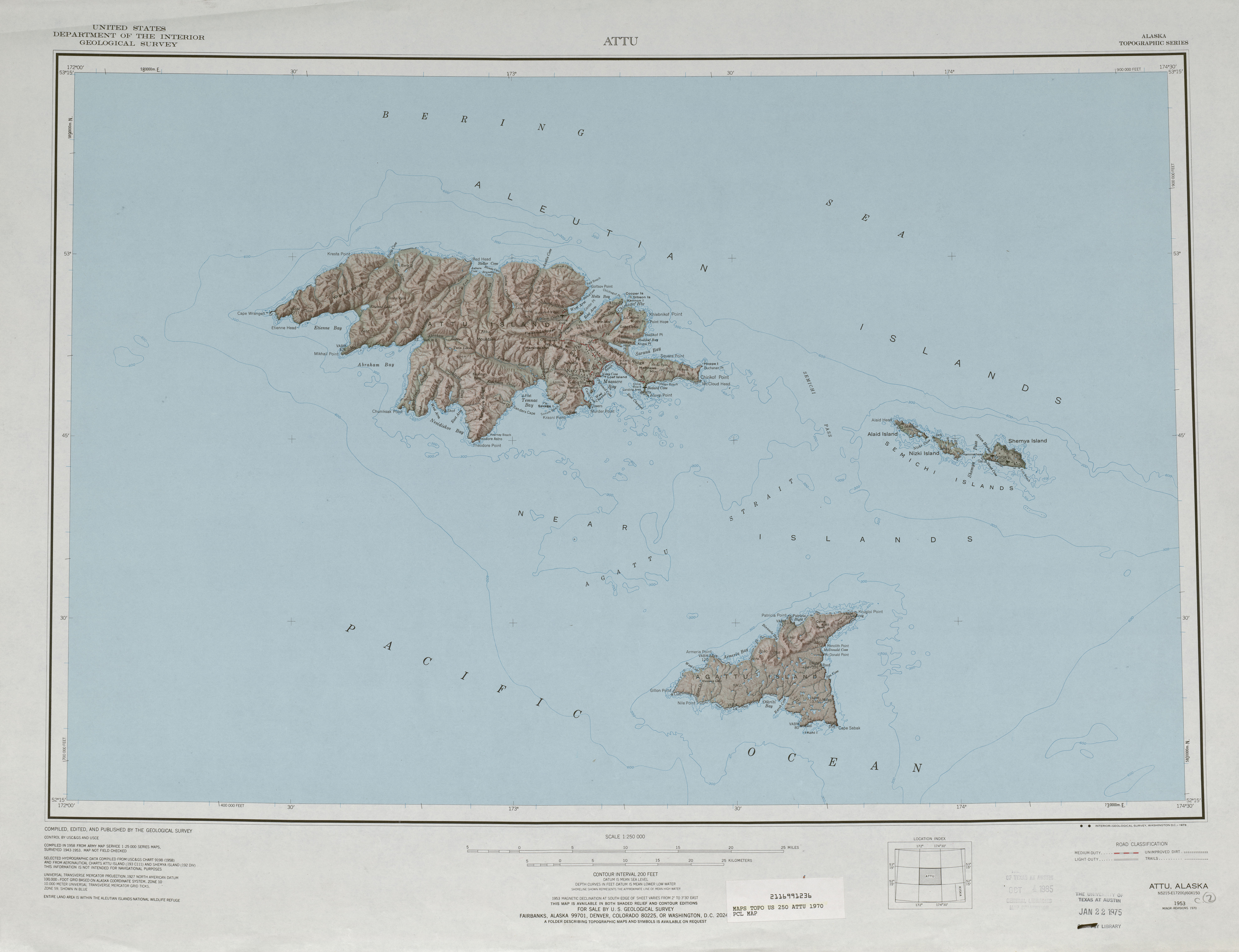
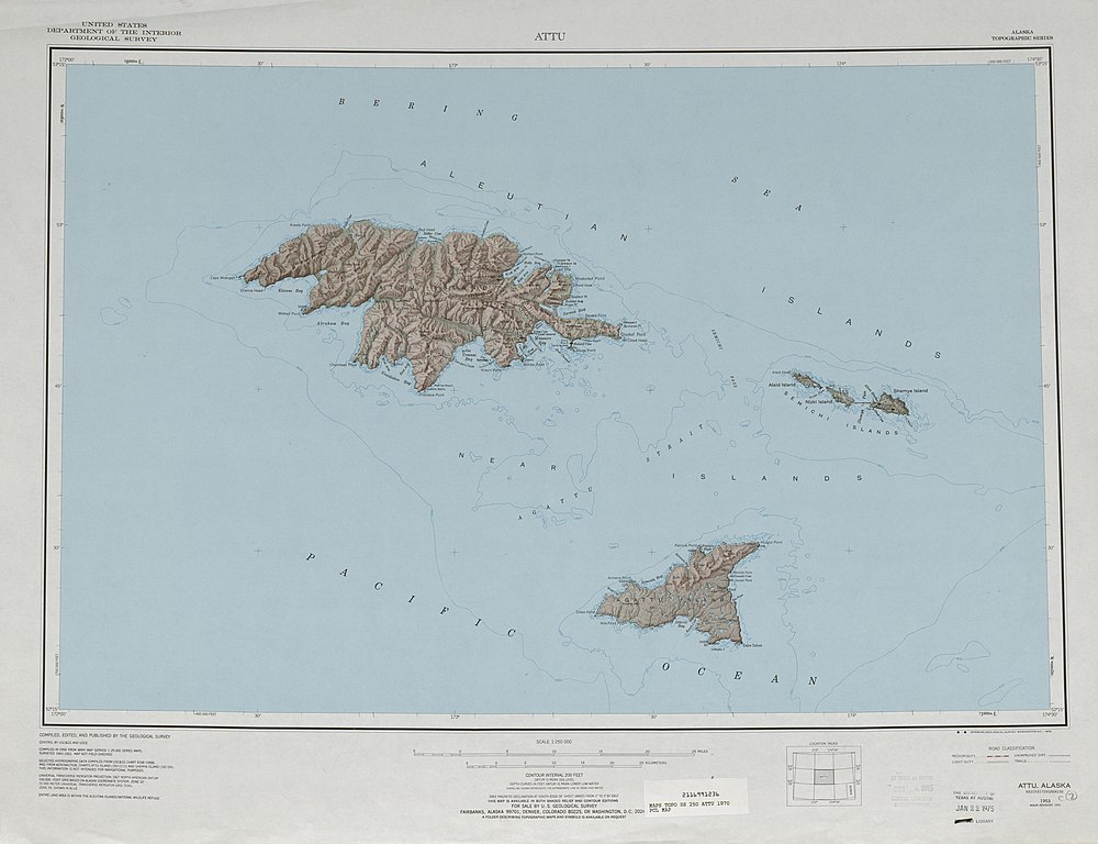
English: 1:250,000 map sheet with Attu Island, Agattu Island, and Semichi Islands |
| Datum | |
| Bron | http://www.lib.utexas.edu/maps/topo/250k/txu-pclmaps-topo-us-attu-1970.jpg |
| Auteur | US Geological Survey |
Licentie
Deze afbeelding bevindt zich in het publiek domein omdat het materiaal bevat dat oorspronkelijk afkomstig is van de United States Geological Survey, een agentschap van de United States Department of the Interior. Voor meer informatie, zie het officiële USGS-auteursrechtenbeleid
|
Bestandsgeschiedenis
Klik op een datum/tijd om het bestand te zien zoals het destijds was.
| Datum/tijd | Miniatuur | Afmetingen | Gebruiker | Opmerking | |
|---|---|---|---|---|---|
| huidige versie | 2 okt 2010 20:38 | | 5.951 × 4.572 (2,92 MB) | Ratzer | {{Information |Description={{en|1=1:250,000 map sheet with Attu Island, Agattu Island, and Semichi Islands}} |Source=http://www.lib.utexas.edu/maps/topo/250k/txu-pclmaps-topo-us-attu-1970.jpg |Author=US Geological Survey |Date=1970 |Permission= |other_ver |
Bestandsgebruik
Dit bestand wordt op de volgende 2 pagina's gebruikt:
Globaal bestandsgebruik
De volgende andere wiki's gebruiken dit bestand:
- Gebruikt op ast.wikipedia.org
- Gebruikt op az.wikipedia.org
- Gebruikt op bg.wikipedia.org
- Gebruikt op bn.wikipedia.org
- Gebruikt op de.wikipedia.org
- Gebruikt op en.wikipedia.org
- Gebruikt op eo.wikipedia.org
- Gebruikt op es.wikipedia.org
- Gebruikt op it.wikipedia.org
- Gebruikt op ja.wikipedia.org
- Gebruikt op pt.wikipedia.org
- Gebruikt op ru.wikipedia.org
- Gebruikt op uk.wikipedia.org
- Gebruikt op zh.wikipedia.org