
Bestand:5.87788E 52.05957N Deelen airbase.png

Grootte van deze voorvertoning: 800 × 493 pixels. Andere resoluties: 320 × 197 pixels | 640 × 394 pixels | 990 × 610 pixels.
Oorspronkelijk bestand (990 × 610 pixels, bestandsgrootte: 605 kB, MIME-type: image/png)
| Dit is een bestand van Wikimedia Commons. Onderstaande beschrijving komt van de beschrijving van het bestand daar. |
| Beschrijving |
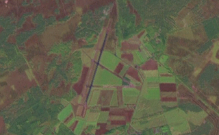
English: View of the Deelen Air Base in the Netherlands. Made using the NASA Worldwind program, 4.8km altitude. |
|||
| Datum | Datum onbekend | |||
| Bron | NASA Worldwind, Landsat 7 Pseudo color overlay | |||
| Auteur | NASA | |||
| Toestemming (Hergebruik van dit bestand) |
|

Bestandsgeschiedenis
Klik op een datum/tijd om het bestand te zien zoals het destijds was.
| Datum/tijd | Miniatuur | Afmetingen | Gebruiker | Opmerking | |
|---|---|---|---|---|---|
| huidige versie | 27 apr 2013 18:47 | | 990 × 610 (605 kB) | Oaktree b | {{Information |Description ={{en|1=View of the Deelen Air Base in the Netherlands. Made using the NASA Worldwind program, 4.8km altitude.}} |Source =NASA Worldwind, Landsat 7 Pseudo color overlay |Author =NASA |Date =Unknow... |
Bestandsgebruik
Dit bestand wordt op de volgende pagina gebruikt:
Globaal bestandsgebruik
De volgende andere wiki's gebruiken dit bestand:
- Gebruikt op de.wikipedia.org
- Gebruikt op en.wikipedia.org
- Gebruikt op pl.wikipedia.org
- Gebruikt op www.wikidata.org