
Bestand:Africa-countries-central.png
Geen hogere resolutie beschikbaar.
Africa-countries-central.png (360 × 392 pixels, bestandsgrootte: 10 kB, MIME-type: image/png)
| Dit is een bestand van Wikimedia Commons. Onderstaande beschrijving komt van de beschrijving van het bestand daar. |

|
Bestand:Africa-countries-central.svg is een vectorversie van dit bestand. Indien niet van slechtere kwaliteit dient deze gebruikt te worden in plaats van deze rasterafbeelding.
File:Africa-countries-central.png → File:Africa-countries-central.svg
Zie Help:SVG voor meer informatie. |
 |
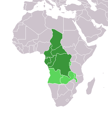
Map of countries in Central Africa.
This map was made by w:User:Joy and originally uploaded to the English Wikipedia as Africa-central-countries.png at 01:32, 28 March 2004. It is a modification of Image:BlankMap-World.png.

|
Toestemming wordt verleend voor het kopiëren, verspreiden en/of wijzigen van dit document onder de voorwaarden van de GNU-licentie voor vrije documentatie, versie 1.2 of enige latere versie als gepubliceerd door de Free Software Foundation; zonder Invariant Sections, zonder Front-Cover Texts, en zonder Back-Cover Texts. Een kopie van de licentie is opgenomen in de sectie GNU-licentie voor vrije documentatie. |
| Dit bestand is gelicenseerd onder de Creative Commons-licentie Naamsvermelding-Gelijk delen 3.0 Unported | ||
| ||
| Deze licentietag is toegevoegd aan dit bestand in verband met de GFDL licentie-update. |
Bestandsgeschiedenis
Klik op een datum/tijd om het bestand te zien zoals het destijds was.
| Datum/tijd | Miniatuur | Afmetingen | Gebruiker | Opmerking | |
|---|---|---|---|---|---|
| huidige versie | 17 mrt 2018 20:21 | | 360 × 392 (10 kB) | Maphobbyist | Montenegro border |
| 13 jan 2014 20:06 |  | 360 × 392 (10 kB) | VVVF | Some corrections | |
| 9 jul 2011 21:52 |  | 360 × 392 (13 kB) | Maphobbyist | South Sudan has become independent on July 9, 2011. Sudan and South Sudan are shown with the new international border between them. | |
| 5 mei 2006 13:10 |  | 360 × 392 (4 kB) | Hautala | optimized with png | |
| 29 apr 2005 20:30 |  | 360 × 392 (14 kB) | ChongDae | from en:Image:Africa-countries-central.png {{GFDL}} Category:Maps of Africa |
Bestandsgebruik
Dit bestand wordt op de volgende pagina gebruikt:
Globaal bestandsgebruik
De volgende andere wiki's gebruiken dit bestand:
- Gebruikt op fr.wikipedia.org
- Gebruikt op he.wikipedia.org
- Gebruikt op ht.wikipedia.org
- Gebruikt op incubator.wikimedia.org
- Gebruikt op is.wikipedia.org
- Gebruikt op is.wiktionary.org
- Gebruikt op kaa.wikipedia.org
- Gebruikt op kbd.wikipedia.org
- Gebruikt op ko.wikipedia.org
- Gebruikt op ky.wikipedia.org
- Gebruikt op mg.wikipedia.org
- Gebruikt op nn.wikipedia.org
- Gebruikt op oc.wikipedia.org
- Gebruikt op pl.wikipedia.org
- Gebruikt op ru.wikipedia.org
- Gebruikt op sl.wikipedia.org
- Gebruikt op sv.wikipedia.org
- Gebruikt op sv.wikinews.org
- Gebruikt op szl.wikipedia.org
- Gebruikt op tk.wikipedia.org
- Gebruikt op tt.wikipedia.org
- Gebruikt op uk.wikipedia.org
- Gebruikt op uz.wikipedia.org
- Gebruikt op wo.wikipedia.org
- Gebruikt op yi.wikipedia.org