
Bestand:Turks and Caicos Islands location map.svg

Afmetingen van deze voorvertoning van het type PNG van dit SVG-bestand: 800 × 516 pixels Andere resoluties: 320 × 206 pixels | 640 × 413 pixels | 1.024 × 660 pixels | 1.280 × 825 pixels | 2.560 × 1.651 pixels | 1.126 × 726 pixels.
Oorspronkelijk bestand (SVG-bestand, nominaal 1.126 × 726 pixels, bestandsgrootte: 271 kB)
| Dit is een bestand van Wikimedia Commons. Onderstaande beschrijving komt van de beschrijving van het bestand daar. |
| Beschrijving |
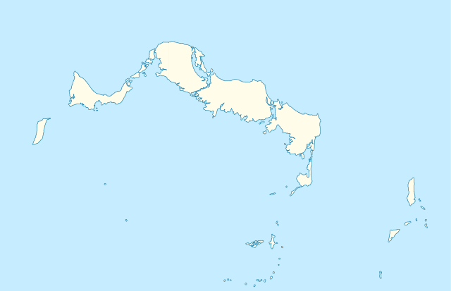
Deutsch: Positionskarte der Turks- und Caicosinseln
Quadratische Plattkarte, N-S-Streckung. Geographische Begrenzung der Karte:
English: Location map of the Turks and Caicos Islands
Equirectangular projection, N/S stretching. Geographic limits of the map:
|
| Datum | |
| Bron | own work, using the General Mapping Tools |
| Auteur | Carport |
| Toestemming (Hergebruik van dit bestand) |
Dit bestand is gelicenseerd onder de Creative Commons-licentie Naamsvermelding-Gelijk delen 3.0 Unported
|

|
Deze kaart is gemaakt of verbeterd in de Duitse Kartenwerkstatt (Map Lab). Je kunt ook zelf kaarten ter verbetering voorstellen.
|
Bestandsgeschiedenis
Klik op een datum/tijd om het bestand te zien zoals het destijds was.
| Datum/tijd | Miniatuur | Afmetingen | Gebruiker | Opmerking | |
|---|---|---|---|---|---|
| huidige versie | 9 apr 2010 11:38 | | 1.126 × 726 (271 kB) | Carport | borders corrected |
| 9 apr 2010 11:30 |  | 1.126 × 726 (271 kB) | Carport | {{Information |Description= {{de|Positionskarte der {{w|Turks- und Caicosinseln|3=de}} }} Quadratische Plattkarte, N-S-Streckung. Geographische Begrenzung der Karte: * N: 22.10° N * S: 21.14° N * W: 72.60° W * O: 71.00° W {{en|Location map of the {{w| |
Bestandsgebruik
Dit bestand wordt op de volgende pagina gebruikt:
Globaal bestandsgebruik
De volgende andere wiki's gebruiken dit bestand:
- Gebruikt op af.wikipedia.org
- Gebruikt op an.wikipedia.org
- Gebruikt op ar.wikipedia.org
- Gebruikt op ast.wikipedia.org
- Gebruikt op ba.wikipedia.org
- Gebruikt op be-tarask.wikipedia.org
- Gebruikt op be.wikipedia.org
- Gebruikt op bg.wikipedia.org
- Gebruikt op ceb.wikipedia.org
- Plantilya:Location map United Kingdom Turks and Caicos Islands
- Long Bay
- Bird Island
- High Rock
- Grassy Creek
- South Rock
- South Bluff
- Blue Hills
- White Cay
- Water Cay
- Southwest Point
- Salt Cay
- Caye de Sel
- Pine Cay
- Hog Cay
- Pelican Cay
- Pear Cay
- Mangrove Cay
- Long Cay
- Iguana Cay
- French Cay
- Fish Cays
- Cotton Cay
- Conch Cay
- Cockburn Town
- Chalk Sound
- Breezy Point
- The Bight
- Ambergris Cays
- Toney Rock
- East Cay
- Seal Cays
- Little Water Cay
- Sand Cay
- East Bay
Globaal gebruik van dit bestand bekijken.