
London Colney
| Civil parish in Engeland | |||
|---|---|---|---|
 | |||
| Situering | |||
| Regio | East of England | ||
| Graafschap | Hertfordshire | ||
| District | St Albans | ||
| Coördinaten | 51° 44' NB, 0° 18' WL | ||
| Algemeen | |||
| Oppervlakte | 5,1298 km² | ||
| Inwoners (2011) |
9507 (1853 inw./km²) | ||
| Overig | |||
| Postcode(s) | AL2 | ||
| Netnummer(s) | 01727 | ||
| Grid code | TL175045 | ||
| Post town | ST ALBANS | ||
| ONS-code | E04004805 | ||
| Foto's | |||

| |||
| Hoogstraat | |||
| |||
London Colney is een civil parish in het bestuurlijke gebied St Albans, in het Engelse graafschap Hertfordshire. De plaats telt 9507 inwoners.
-
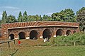
 The Hull, London Colney
 -
 Brug over de Colne in London Colney


| Bronnen, noten en/of referenties |
Geplaatst op:
15-07-2007 |
Dit artikel is een beginnetje over landen & volken. U wordt uitgenodigd om op bewerken te klikken om uw kennis aan dit artikel toe te voegen. |